

Thunderstorms: Savoie and Haute-Savoie under a yellow warning this Friday
Published 2 October 2026 at 09:52 (Paris time) · updated 2 October 2026 at 10:25 (Paris time)
Lire cet article en français →
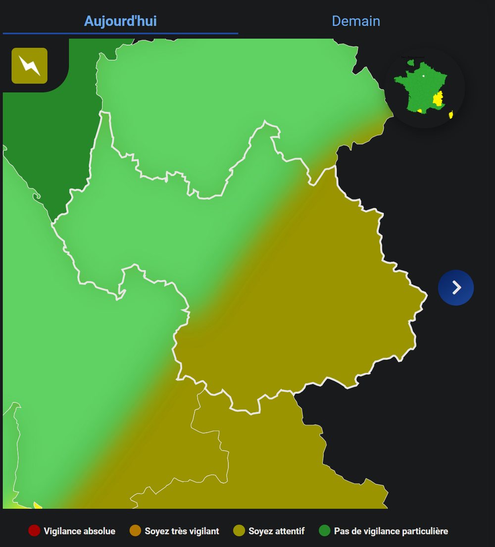
Météo-France has placed Savoie and Haute-Savoie, as well as Isère and Drôme, under a yellow thunderstorm warning for this Friday, 2 October. The area concerned mainly covers the east and south of Savoie; storms are expected to break out over the mountains in the afternoon.

In its bulletin issued this Friday, 2 October at 6:00, Météo-France puts nine departments under a yellow thunderstorm warning. In the Northern Alps, Savoie (73) and Haute-Savoie (74) are concerned, as are Isère and Drôme.
When and where?
According to Lyon Capitale, the warning runs from noon to 8 pm. Storms should develop mainly in the afternoon over the mountains. They may be locally strong, with heavy rain and a risk of rivers rising quickly.
Météo-France now draws its warnings within departments. On its map, the yellow area mainly covers the east and south of Savoie — Tarentaise and Maurienne — and extends towards Isère and Hautes-Alpes. The west of Savoie, including Albertville and Chambéry, stays green, and only a small part of Haute-Savoie is affected.
What does a yellow warning mean?
It is the first warning level: weather that is usual for the region but can be locally dangerous. In the mountains, set off early and come down before mid-afternoon, avoid ridges and summits if a storm threatens, and keep away from mountain streams, which can swell very quickly.
And Saturday?
In the same 6:00 bulletin, no department of the Northern Alps is under a warning for Saturday 3 October: only Aude, Gard, Hérault and Pyrénées-Orientales are. Météo-France updates its map at least twice a day, at 6:00 and 16:00.
The rain had already arrived on Thursday: our Albertville weather station recorded 13.2 mm over the day (see the readings).
Sources
- Météo-France — Vigilance accessible (bulletin du 2 octobre 2026, 6 h)
- Météo-France — Vigilance Savoie (73), carte du 2 octobre 2026
- Lyon Capitale — Quatre départements d’Auvergne-Rhône-Alpes en vigilance orages (2 octobre 2026)
- Tameteo — Orages : les neuf départements placés en vigilance jaune ce vendredi (2 octobre 2026)
- Station Savoie Snow d’Albertville — historique
Written by Savoie Snow from these sources, consulted on the day of publication, and from the site’s own data.